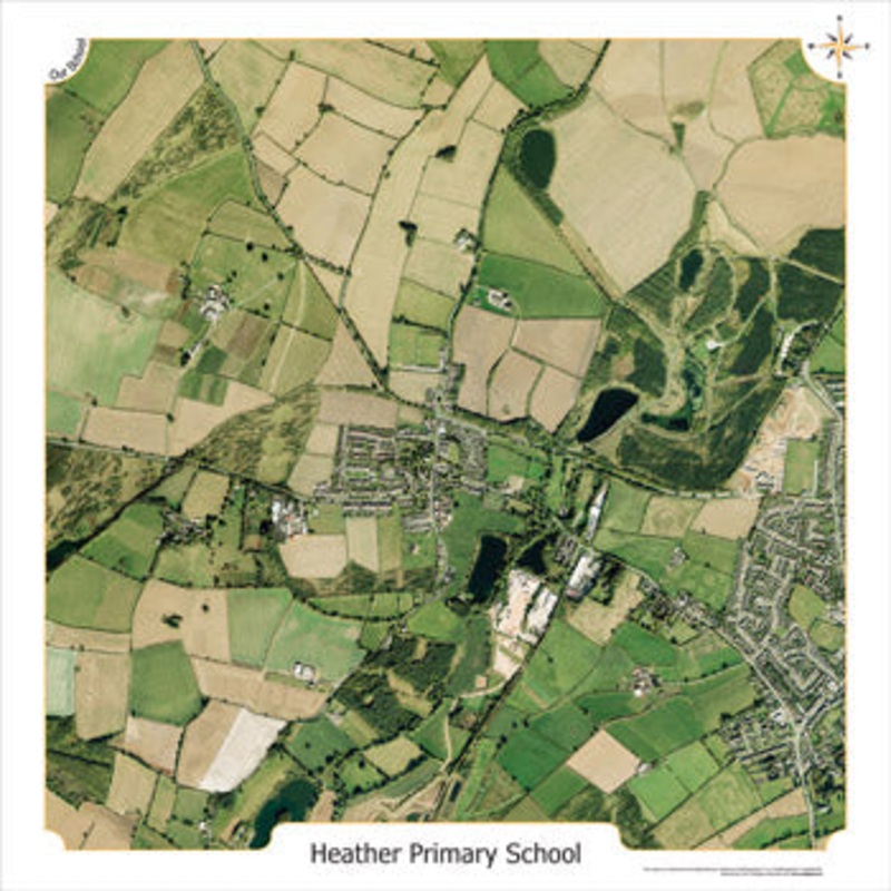
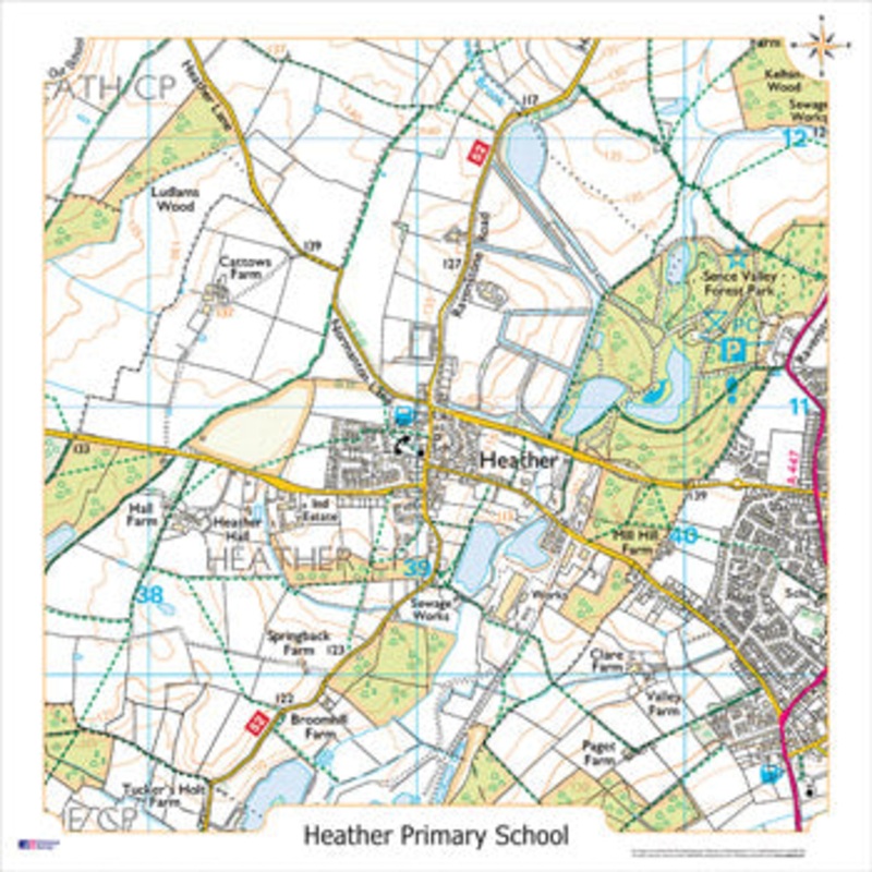
Please supply the Postcode of your School/Establishment to be used as the centre of the map with your order. This Aerial Photograph is centred on the postcode of your school, giving a 2km overview of the surrounding area. The stunning 10:000 scale data is
Flash Sale Ongoing
Please supply the Postcode of your School/Establishment to be used as the centre of the map with your order. This Aerial Photograph is centred on the postcode of your school, giving a 2km overview of the surrounding area. The stunning 10:000 scale data is ideal for working at a local or community level providing details such as fences, field boundaries, road names and buildings. This map comes mounted onto rigid 3mm board and includes pre-drilled holes and fixings. Size 1000 x 1000mm. All maps are based on your school’s postcode.


Reviews
There are no reviews yet.