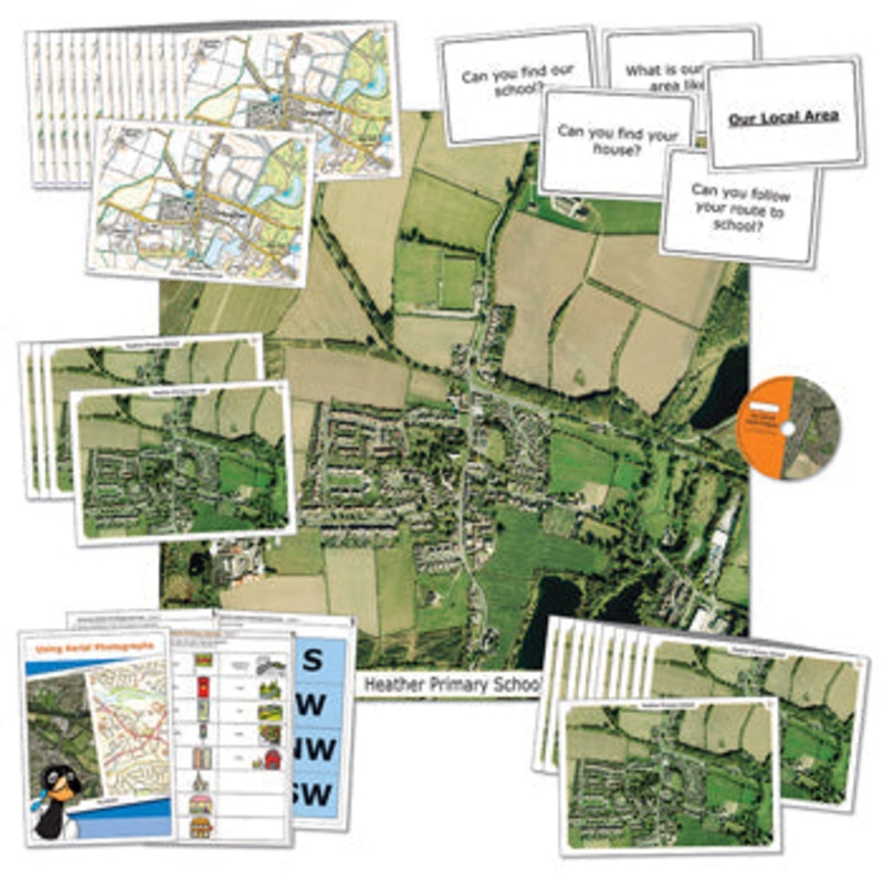
Please supply the Postcode of your School/Establishment to be used as the centre of the map with your order. A collection of current and historical Aerial Photographs and ordnance survey maps local to your school. Pack includes: 1000 x 1000mm sized floor m
Flash Sale Ongoing
Please supply the Postcode of your School/Establishment to be used as the centre of the map with your order. A collection of current and historical Aerial Photographs and ordnance survey maps local to your school. Pack includes: 1000 x 1000mm sized floor mat (durable wipe clean vinyl) featuring 2 x 2km aerial view of your school locality in detail. 10 x A4 current aerial photographs 10 x A4 19th century laminated All 3 Aerial Photographs on a slide show CD Teacher notes and suggested lesson plans Booklet on how to use your Aerial Photograph, All maps are based on your school’s postcode.

Reviews
There are no reviews yet.